Back منطقة هوشانجباد Arabic هوشانجباد ARZ होशंगाबाद जिला Bihari হোশঙ্গাবাদ জেলা Bengali/Bangla Districte de Narmadapuram Catalan Hoshangābād (distrito) CEB Narmadapuram (Distrikt) German Distrito de Narmadapuram Spanish Hoshangabad barrutia Basque بخش هوشنگآباد Persian
Hoshangabad district
Narmadapuram district | |
|---|---|
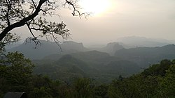
Clockwise from top-left: Satpura Range at Chauragarh, Adamgarh Hills, Sethani ghat at Hoshangabad, Dhupgarh, Tawa River | |
 Location of Hoshangabad district in Madhya Pradesh | |
| Country | |
| State | Madhya Pradesh |
| Division | Narmadapuram |
| Headquarters | Hoshangabad |
| Tehsils | 08
01 Itarsi 02 Hoshangabad 03 Seoni Malwa 04 Sohagpur 05 babai 06 Bankhedi 07 Dolariya 08 Pipariya |
| Government | |
| • Lok Sabha constituencies | Hoshangabad |
| • Vidhan Sabha constituencies | Hoshangabad-Itarsi |
| Area | |
| • Total | 5,408 km2 (2,088 sq mi) |
| Population (2011) | |
| • Total | 1,241,350 |
| • Density | 230/km2 (590/sq mi) |
| • Urban | 35% |
| Demographics | |
| • Literacy | 76.52 per cent |
| • Sex ratio | 912 females/1000 males |
| Time zone | UTC+05:30 (IST) |
| Major highways | NH69, SH15, SH19, SH19A, SH22 |
| Average annual precipitation | 1006~1350 mm |
| Website | narmadapuram |
Hoshangabad district, officially Narmadapuram district, is one of the districts of Madhya Pradesh state of India, and Hoshangabad city is the district headquarters.


